
In the late 1800’s to the early 1900’s many visitors to Hot Springs were visiting in search of healing.
Doctors would prescribe a soak in a specific thermal spring or even a hike on a specific trail to help alleviate aches or pains of patients. Most notably, legendary Major League Baseball players visiting Hot Springs for Spring Training would hike the trails to stay in shape when off the field. Hiking has been a part of Hot Springs history for years and still to this day provides a healing purpose to visitors and locals alike. We’ve compiled a list of 10 Hiking Trails to Explore during your visit to Hot Springs - so lace up your shoes and take a hike!
HOT SPRINGS NATIONAL PARK

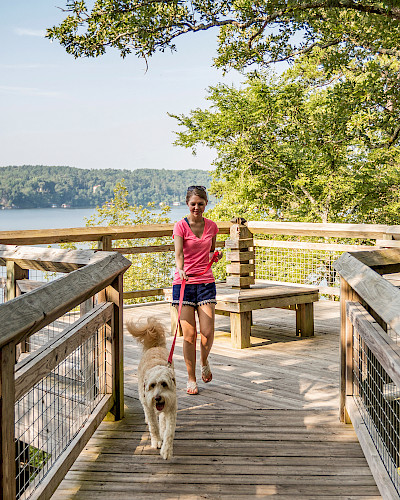
What’s the best thing about the trails in Hot Springs? There’s something for everyone! With trails as short as 0.5 mile to as long as 18 miles, the park is yours to explore! Dogs are welcome on all of the trails, be sure to keep them on a leash and clean up after them. As always, please practice the “Leave No Trace” principles while hiking in Hot Springs so if you pack it in, pack it out!
Goat Rock Trail
This moderate, 1.1 mile trail is full of interesting geological formations and offers a wonderful view of the Ouachita Mountains and the recharge zone for the springs. After a rain, there are many ephemeral springs and creeks that flow across the trail. Park at the North Mountain overlook or near the Shelter on top of North Mountain to access the trail head.
Peak Trail to Hot Springs Mountain Loop
Start this 2.9 mile hike right from Bathhouse Row. The Peak Trail (0.6 mi) will take you right up to the top of Hot Springs Mountain and remind you that you’re alive after your ascent. From there, hop on the 1.7 mile Hot Springs Mountain Loop for a lovely and shady hike around the top of Hot Springs Mountain. The trail will reconnect with the Peak Trail and bring you right back where you started.
West Mountain Loop
This 3.3 mile moderate to strenuous loop will take you all the way to the top and around West Mountain. You’ll come across some really neat rocky outcroppings, you’ll get some spectacular views of downtown Hot Springs, and you’ll feel like you’re a million miles away from downtown.
Oertel Trail to Goat Rock to Upper Dogwood to Hot Springs Mountain to Peak
This is a very fun and dynamic 5.4 mile loop around Hot Springs Mountain. Starting on the Oertel Trail, you’ll climb your way up one of the steepest sections of trail in the park! Luckily, it doesn’t last very long and it’s a smooth(ish) hike from there. Catch the Gulpha Gorge Trail until it meets the Goat Rock Trail. Follow Goat Rock to the Upper Dogwood Trail (Ranger Ashley’s current favorite trail), and loop down to the Hot Springs Mountain Trail before catching the Peak Trail and heading back towards Bathhouse Row.
The Sunset Trail
This mile is 13-18 miles of pure hiking bliss and makes an entire loop around Hot Springs National Park. To complete the shortest version of this hike, you’ll want to start on the Oak Trail (next to Grateful Head Pizza) and head towards the Sunset Trail on top of West Mountain. Follow the Sunset Trail all the way around for 10 miles until it reaches the Gulpha Gorge Campground. From there, hike up Gulpha Gorge Trail for a little bit until you connect with the Oertel Trail. The Oertel will bring you back down to Bathhouse Row to complete the whole loop in 13 miles. Be sure to take plenty of water, snacks, and a lunch. This hike takes roughly 6-8 hours to complete, but it’s definitely worth it. Click here for Hot Springs National Park hiking trail maps.
- Ranger Ashley Waymouth, Hot Springs National Park
 ENTERGY PARK TRAIL SYSTEM
Entergy Park, located on the shore of Lake Hamilton in Hot Springs at 530 Lakepark Drive, has many opportunities for hiking, featuring nine trails with a total length of 2.8 miles. Five of the trails are asphalt/hard surface (ADA accessible), and the other four are natural surface. While all the trails in this park are wonderful for an easy to moderate hike, the Lakefront Trail offers spectacular views of Lake Hamilton as well as Carpenter Dam. This trail weaves its way through native pines and hardwoods, has an abundance of wildflowers, and is a perfect place to take in a lake view sunset. The North Loop Trail is highly utilized by walkers and bicyclists, and is the asphalt surface trail used for the annual Tikes, Trikes and Trails event. Many love the Wildlife Observation Trail, where there is an overlook with a breathtaking view of the lake and historic markers that tell how the land was used to house families of the men who built Carpenter Dam in the 1920-30’s. The trails at Entergy Park can be accessed by land or by boat. Boat docks and a launching ramp next door at Sunnybrook Landing connect to the park via a wooden pedestrian bridge, and there are courtesy docks located along the Sunnybrook Connector Trail. Although short, at only .1 mile, the Eagle Scout Trail is a challenging natural surface trail that wraps around the southeast parking lot and ends at the pedestrian bridge. Fishing piers and a gazebo can be accessed along the Pavilion on the Point Trail. The longest trail at the park is the Water Tower Loop Trail, a natural surface trail that meanders through the woods in the north corner of the park. It connects to the Fenceline Trail in the northwest portion of the park. Lastly, the Playground Connector Trail is where hikers can find pavilions, playgrounds, water fountains, and restrooms. The park is great for wedding receptions, family reunions, birthday parties, or just a morning jog. Come check it out! Click here for the city of Hot Springs trail maps.
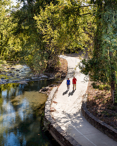 HOT SPRINGS CREEK GREENWAY TRAIL
The Hot Springs Creek Greenway Trail is a shared-use 12 ft. wide hard surface trail designed to parallel the Hot Springs Creek for four miles from downtown to where it enters Lake Hamilton. Many city entities are found along the way, e.g., the Garland County Veteran’s Memorial, Hot Springs Farmer’s & Artisan’s Market, Sculpture Garden, Sponsor’s Plaza, Valley Street Skatepark, Monarch Butterfly Garden, the Majestic Ballpark, Garland County Master Garden’s Xeriscape Garden, and Hollywood Park. There are also many benches, water fountains, overlooks and pedestrian bridges along the way. You will enjoy beautiful views and sounds of the running creek, flora and fauna as you travel the length of the greenway. Whether you are walking, jogging, riding a bike, skateboarding, or rollerblading you will find the trail accommodates many forms of alternate transportation methods. It is ADA accessible and with so many neighborhood connections it is a wonderful way to travel to and from downtown Hot Springs. Click here for the city of Hot Springs trail maps. - Anthony Whittington, Hot Springs Parks & Trails
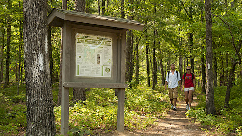
 NORTHWOODS TRAILS
The Northwoods Trails are located on City of Hot Springs, Garland County, and National Park lands. With almost 30 miles of trail, it is conveniently located just three short miles from downtown Hot Springs. The 2000 acre city property includes three lakes which are a beautiful site to see. I start my hike at the Waterworks Trailhead located at 300 Pineland Drive. As I drive down Pineland Driveb towards the parking lot, I often catch a glimpse of riders and hikers on the trails to the left of the road. My hike begins on the Bees Knees Trail, ascending on the rolling path to Hub W. Continuing north onto Dewdropper Trail, it drops me down to the west end of Freeman Trail. As I cross the Freeman Bridge, I’m sure to take time to see what life may be moving in the water below me. I then continue along Freeman Trail which follows the north bank of Dillon Lake, stopping at “Sitting Rock” to take in the view of the water and breath in the fresh air. As I resume my hike around the bend, I hear the sound of moving water and the view opens up to the Sanderson Dam. For my return, I retrace my steps enjoying the views once more before ending my hike at beautiful Bethel Lake. This out and back route is roughly a three mile hike. Adventure On! Click here for the Northwoods Trails maps. -Traci Berry, Northwoods Trails Coordinator.
FALLS BRANCH TRAIL
Lake Catherine State Park offers a moderate hiking trail that follows along the Lake Catherine shoreline and leads to a seasonal waterfall. Driving to the trailhead from Malvern Avenue, take Exit #97 off I-30 at Malvern and travel 12 miles north on Arkansas Hwy. 171 to Lake Catherine State Park. The Falls Branch Trail begins near the campground and winds 1.7 miles through the pine forest and over Little Canyon Creek. This route to the Falls Creek Falls Waterfall will bring you to the top of the waterfall with a trail leading to the bottom. Along the top of the waterfall trail area you will find lush green moss growing along small cool pools of water making its way towards the falls. For a more casual hike to the waterfall, follow the path to the left of the campground parking lot which will bring you to a wooden hanging bridge crossing Little Canyon Creek. This route is approximately a half mile hike to the Falls Creek Falls Waterfall and will bring you directly to the bottom of the waterfall. On a hot summer day, take a refreshing dip in the swimming hole under the waterfall. Keep in mind, the flow of the waterfall will depend on the amount of rainfall received in the area. Pack a lunch for a picnic with a view and bring your pup along for the hike; dogs on a leash are welcome on the trail. For more information on Lake Catherine State Park and the Falls Branch Trail, click here. Check out our Diamond Roads Series video below featuring the Falls Branch Trail and Falls Creek Falls before your visit!
LAKE OUACHITA VISTA TRAIL
The Lake Ouachita Vista Trail (LOViT) is about 40 miles of point to point trail in the Ouachita National Forest, starting Blakely Dam and ending near Crystal Springs. The west end of the LOViT trail is considered easy to moderate, with rolling hills between the Joplin and Denby Campgrounds. The east end is considered moderate to difficult, dominated by a long ride along the mountain ridge. The LOViT trail travels up and down along mountain slopes offering several breathtaking view points like the Hickory Nut Mountain Overlook. This trail meets several refreshing cold creek crossings, so prepare in advance to get your feet a bit wet. The LOViT trail is also an IMBA Epic Trail, which means it's a true backcountry riding experience that's at least 80 percent singletrack and at least 20 miles in length. Take a hike, ride a bike, and take in the views of the immersive experience that is the Lake Ouachita Vista Trail. Click here for the Lake Ouachita Vista Trail map.
There’s no shortage of amazing hiking trails to enjoy in Hot Springs! Treat yourself to a much needed nature escape with hiking in Hot Springs. Be sure to add our list of Top 10 Hikes in Hot Springs to your itinerary before your visit!